|
Back to Home Page
Site
Links
Biographies
Births
Cemetery
Information
Census Records
Churches
Cities and Towns
County History
Death Records
Families
Maps
Marriages
Military Records
Newspaper Clippings
Obituaries
Collection
Postcards and
Photos
Research Links
Surname Registry
External
Links
Find A Grave
Message Board from
Ancestry.com
UsGenWeb Mower
County Archives
USGenWeb Special
Projects
|
|
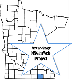
Welcome
to the
Mower County MNGenWeb Project
Maps
Austin Map, 1940
Minnesota Counties
Minnesota
Territorial Map, 1849 - 1851
Mower County
Detailed Map with Cemeteries
Mower County Map
Mower County Map,
1909
Mower County
Railroad Map, 1874
Mower County
Townships
Sargeant Map, 1896
Southern Minnesota
Area Map
Southern Minnesota
Galbraith Railroad Map, 1897
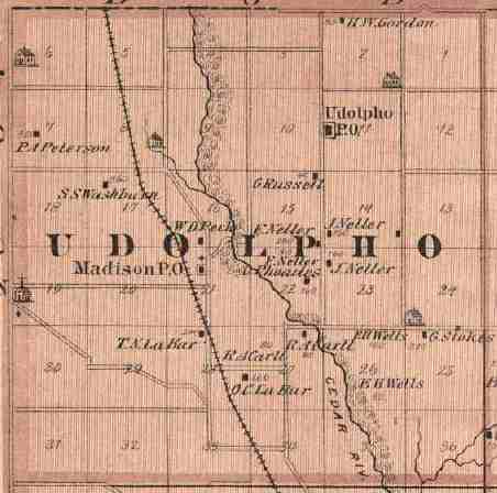
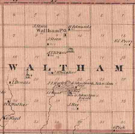
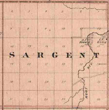
These are
township maps from 1874, shown here in the arrangement in which they actually
exist. Larger sized maps are more detailed.
|
Udolpho
|
Waltham
|
Sargeant
|
Pleasant
Valley
|
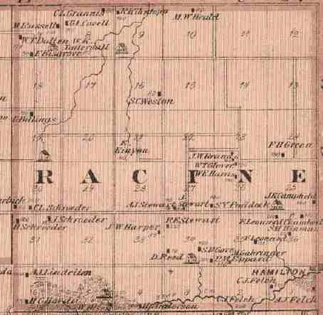
Racine
|
|
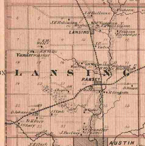
Lansing
|
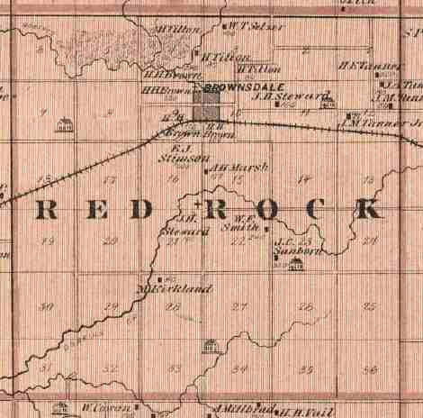
Red Rock
|
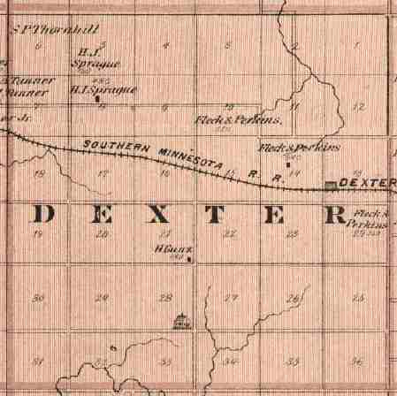
Dexter
|
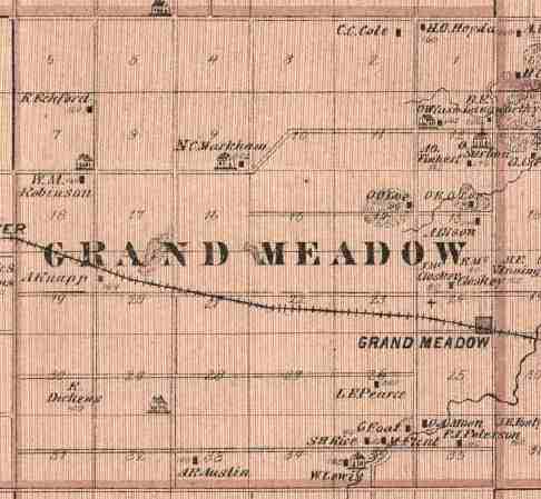
Grand
Meadow
|
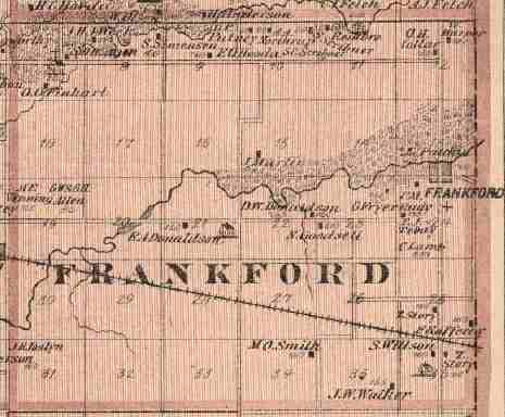
Frankford
|
|
Austin
|
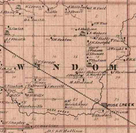
Windom
|
Marshall
|
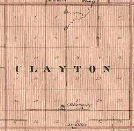
Clayton
|
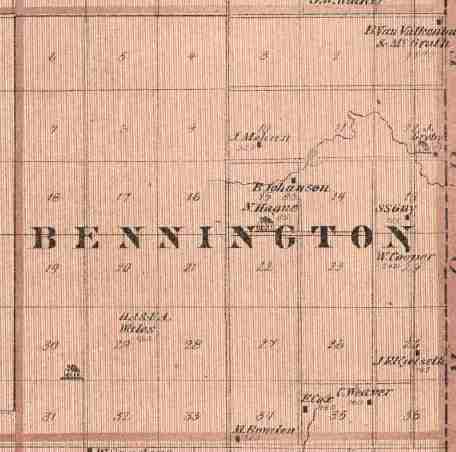
Bennington
|
|
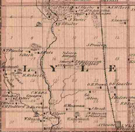
Lyle
|
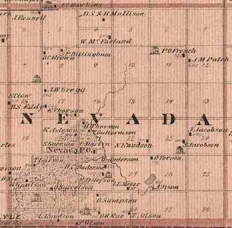
Nevada
|
Adams
|
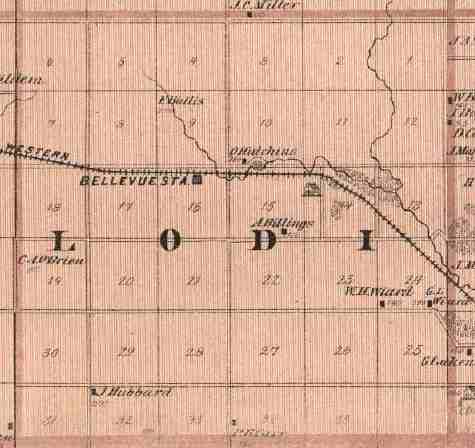
Lodi
|
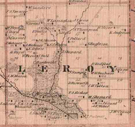
Leroy
|
|